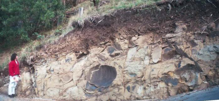
Cutting showing fractured sandstone and soil cover at Morley Avenue, Wye River
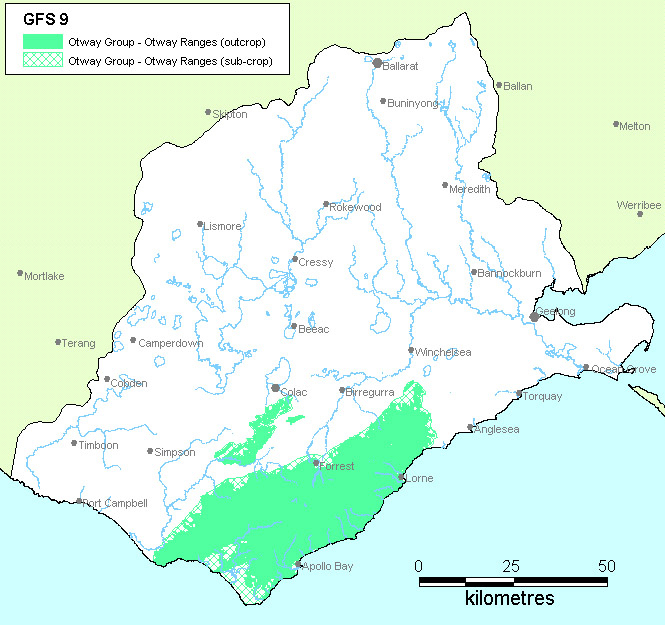
Region: Southern CCMA (Southern Victoria Uplands)
Type areas: Wye River, Beech Forest, Forest, Lavers Hill
Description: The lithic sandstone and mudstone rocks that make up the Otway Ranges were formed from sediments deposited in a rift valley between Australia and Antarctica during the Cretaceous period. The continued uplift and erosion of the Otway Ranges since the Miocene has created deeply dissected landscapes with thin soils. The majority of the catchment is forested, with a significant proportion of public land.
Groundwater flows through the fractured rocks in intermediate and local flow systems, recharged by the high rainfall. The groundwater discharge into the streams of the Otway Ranges contributes to urban and farm water supplies, including those utilising the Barwon and Gellibrand Rivers, and groundwater contamination from urban (mostly coastal) development and nutrients may be an emerging threat to water quality. Current knowledge suggests that this GFS does not contribute to the salinity problem.
Geology: Otway Group – Eumeralla Formation (Kl)
Topography: Ridges and steep valleys.
Land Systems:
3.0 South Uplands
3.1 Deeply-dissected upland
3.1.1 Plateau
3.1.2 Dissected ranges
3.1.4 Alluvial terraces and floodplains
Regolith: Skeletal to gradational soils over moderately weathered sedimentary rocks
Annual rainfall: 900 to 1900 mm
Dominant mid-1800s vegetation type: Forest, rainforest
Current dominant land uses: Conservation, water supply, forestry, grazing, dairying, tourism.
Mapping method: Outcrop and estimated sub-crop distribution.
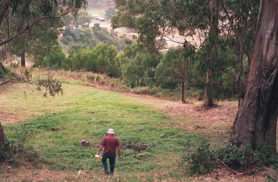
Groundwater discharge at The Boulevard, Wye River
Aquifer type (porosity): Fractured rock (secondary porosity)
Aquifer type (conditions): Unconfined to semi-confined
Hydraulic Conductivity (lateral permeability): Largely unknown. Estimated range from 10-4 m/d to 101 m/d.
Aquifer Transmissivity: Generally less than 1000 m2/d.
Aquifer Storativity: Estimated range from 0.02 to 0.1.
Hydraulic gradient: Generally moderate but can be locally very steep in valleys.
Flow length: Estimated <2 km for local systems up to 15 km for intermediate systems.
Catchment size: Estimated to be <20000 Ha.
Recharge estimate: Unknown. Possibly 200 mm/yr or more.
Temporal distribution of recharge: Seasonal (winter and spring), with more recharge in wetter years.
Spatial distribution of recharge: General catchment wide, with less on steeper slopes.
Aquifer uses: Minor stock and domestic use.
Groundwater salinity: Fresh. Generally less than 1500mg/l.
Salt store: Low
Salinity occurrence: None known.
Soil Salinity Rating: Low (Nil).
Salt export: None known.
Salt impacts: None known.
Soil salinity hazard: Nil.
Water salinity hazard: Nil.
Major assets at risk: Nil
Responsiveness to land management: Unknown, and not applicable to salinity management.
Not a salinity problem. Management should be directed at maintaining water quality and protection from contamination.
Dahlaus, P. Heislers, D. Dyson, P. (2002) Corangamite Catchment Management Authority Groundwater Flow Systems, Report by Dahlhaus Enviornmental Geology Pty Ltd. for the Corangamite Catchment Authority. CCMA 02/02.