The 3D visualisation component of the portal has now been activated via the VVG website
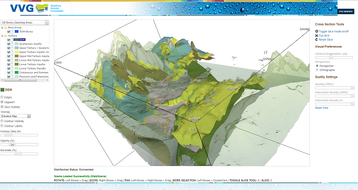
This tool is the result of a collaboration between Federation University Australia and Queensland University of Technology. The system has been designed to take advantage of new web technologies and is currently in beta testing.
The 3D scene allows you to see areas from the VVG portal in 3D. This includes aquifer layers, WMIS bores and surface elevation. Viewing requires Internet Explorer 10 and above, Firefox, Chrome or Safari (latest versions). It is also recommended you have an internet connection of at least 2Mbs and a widescreen monitor. The tool is currently accessed through port 30001, which some organisations (such as Government) may have blocked. We are working on an alternative to this.
A user guide is currently being developed and will be available soon.